About High Junk Peak Country Trail
For breathtaking views over the islands and spectacular bays of the Sai Kung and Clearwater Bay peninsulas, it’s hard to beat a hike on the High Junk Peak Country Trail. Offering panoramic vistas of some of Hong Kong’s most striking landscapes, this scenic countryside area lies only minutes from Tseung Kwan O.
This hike also takes you to a beautiful temple dedicated to Tin Hau, the protector goddess of fisherfolk, and an ancient rock inscription that records the visit of an imperial official to the temple in the 13th century. The trail ends at a remote fishing village, Po Toi O, where you can enjoy a seafood feast before returning to the city.
Refuel
From Ng Fai Tin (or ‘five fields’), a set of steps beside a rain shelter mark the start of your hike. They quickly lead you up onto the forested hillside, as roadside noises are replaced by birdsong. At first, this is a gentle woodland walk, punctuated now and then by brief ascents up rough-hewn boulder steps. Go slowly up the hill (you will probably need your energy later) and admire your progress as you glimpse the high-rise properties of Tseung Kwan O.
This hiking trail doubles up as a mountain bike trail, but the two paths are clearly marked at each fork. It’s not long before gaps in the trees allow you to enjoy coastal views of the bays and villages below. To the east, you can look down at the waters of the pretty Lung Ha Wan (or ‘lobster bay’). To the north, you can see as far as the tall green ridgeline of hills behind Sai Kung town.
The signposted trail detours around Miu Tsai Tun (or ‘small temple mound’) and the challenging summit of High Junk Peak. The path is often flanked by thickets of bamboo that rustle gently as you walk past.
Hikers are rewarded with a spectacular view straight ahead of High Junk Peak and the stunning turquoise waters of Clearwater Bay behind it.
High Junk Peak is also known as Tiu Yue Yung in Chinese, which aptly describes the pointy summit’s resemblance to a fisherman in a cape. The High Junk Peak Country Trail offers magnificent views. Your vista includes the bay of Port Shelter with all its islands, backed by the long mountain ranges of the Sai Kung Country Parks. To the southeast, the shores of Clearwater Bay look out to the distant cluster of islands known as the Ninepin Group.
A moderately challenging descent ends at a forest crossroads with a map board and a lookout point over Tseung Kwan O.
Following the signs for ‘Tai Miu’ will lead you across a high open hillside. The golfing greens of the Clearwater Bay Golf & Country Club are laid out at your feet. To the south, you can see as far as Shek O on Hong Kong Island. And if you look down, you’ll see the Tin Hau Temple in the bay below. Take the steps downhill to find a special rock engraving — in fact, it’s the oldest inscription found in Hong Kong, dating back to the year 1274 during the Southern Song dynasty (1127-1279). The temple is also the largest and oldest Tin Hau temple in the city, dating back to 1266. It sits high above the sea, with an expansive open area in front of it to accommodate the large number of visitors during the annual Tin Hau Festival.
Walk back up to the road, then turn right to get down to sea level where the charmingly ramshackle Po Toi O village is strung out along the shore of a moon-shaped bay. Rickety piers and houses on wooden stilts line the water’s edge, and the bay is filled with floating fish rafts, paddleboarders and small boats. In between the jetties, low-rise cottages and drying fish racks, there are several seafood restaurants where you can reward yourself with a Cantonese-style feast after your big day out.
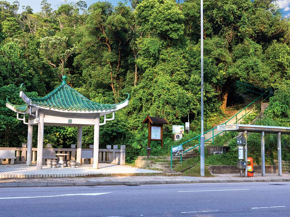
From Ng Fai Tin (or ‘five fields’), a set of steps beside a rain shelter mark the start of your hike. They quickly lead you up onto the forested hillside, as roadside noises are replaced by birdsong. At first, this is a gentle woodland walk, punctuated now and then by brief ascents up rough-hewn boulder steps. Go slowly up the hill (you will probably need your energy later) and admire your progress as you glimpse the high-rise properties of Tseung Kwan O.
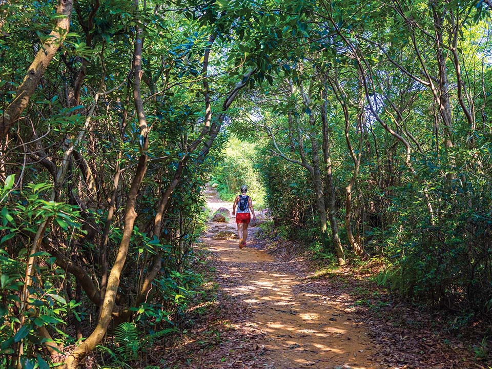
This hiking trail doubles up as a mountain bike trail, but the two paths are clearly marked at each fork. It’s not long before gaps in the trees allow you to enjoy coastal views of the bays and villages below. To the east, you can look down at the waters of the pretty Lung Ha Wan (or ‘lobster bay’). To the north, you can see as far as the tall green ridgeline of hills behind Sai Kung town.
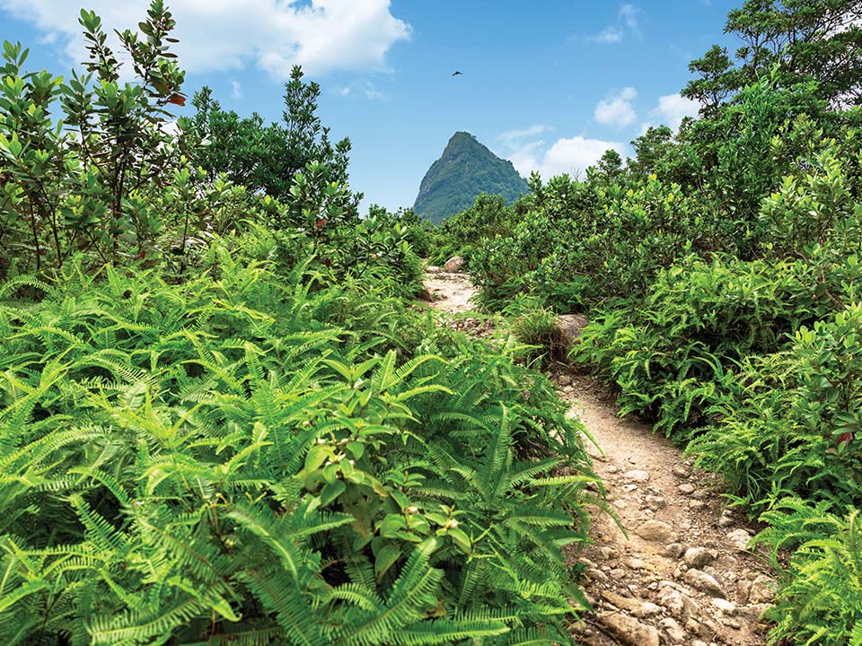
The signposted trail detours around Miu Tsai Tun (or ‘small temple mound’) and the challenging summit of High Junk Peak. The path is often flanked by thickets of bamboo that rustle gently as you walk past.
Hikers are rewarded with a spectacular view straight ahead of High Junk Peak and the stunning turquoise waters of Clearwater Bay behind it.
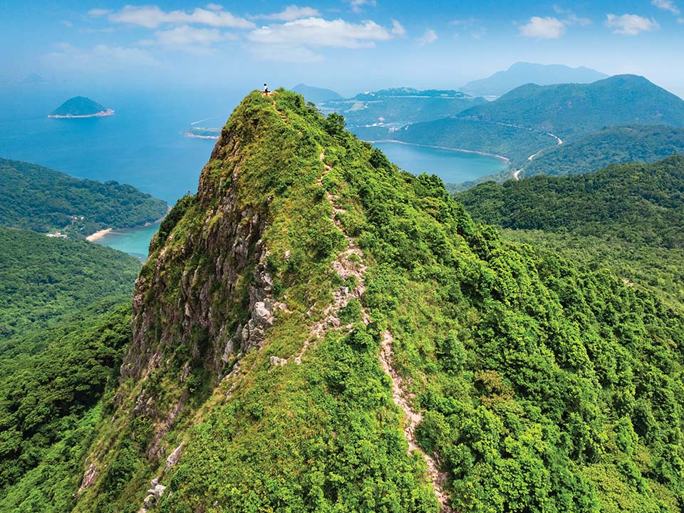
High Junk Peak is also known as Tiu Yue Yung in Chinese, which aptly describes the pointy summit’s resemblance to a fisherman in a cape. The High Junk Peak Country Trail offers magnificent views. Your vista includes the bay of Port Shelter with all its islands, backed by the long mountain ranges of the Sai Kung Country Parks. To the southeast, the shores of Clearwater Bay look out to the distant cluster of islands known as the Ninepin Group.
A moderately challenging descent ends at a forest crossroads with a map board and a lookout point over Tseung Kwan O.

Following the signs for ‘Tai Miu’ will lead you across a high open hillside. The golfing greens of the Clearwater Bay Golf & Country Club are laid out at your feet. To the south, you can see as far as Shek O on Hong Kong Island. And if you look down, you’ll see the Tin Hau Temple in the bay below. Take the steps downhill to find a special rock engraving — in fact, it’s the oldest inscription found in Hong Kong, dating back to the year 1274 during the Southern Song dynasty (1127-1279). The temple is also the largest and oldest Tin Hau temple in the city, dating back to 1266. It sits high above the sea, with an expansive open area in front of it to accommodate the large number of visitors during the annual Tin Hau Festival.
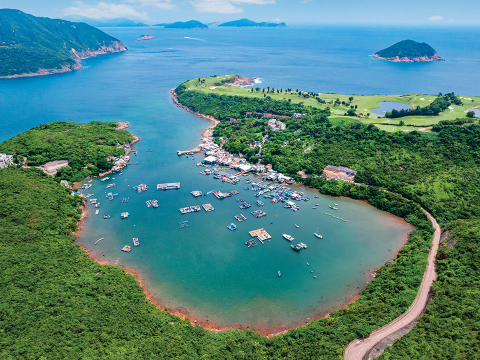
Walk back up to the road, then turn right to get down to sea level where the charmingly ramshackle Po Toi O village is strung out along the shore of a moon-shaped bay. Rickety piers and houses on wooden stilts line the water’s edge, and the bay is filled with floating fish rafts, paddleboarders and small boats. In between the jetties, low-rise cottages and drying fish racks, there are several seafood restaurants where you can reward yourself with a Cantonese-style feast after your big day out.




 Live Chat


